Update: Mount Agung eruption
Further updates 11/27/17
Denpasar Airport (Ngurah Rai International Airport-DPS) is now closed to all inbound and outbound flights until “at least” tomorrow. Lombok Airport is now accepting some flights due to changes in the way the ash cloud is moving.
The evacuation zone around Mount Agung has been extended to 10km (6.2 miles). There are now “lahars,” or slides of debris and mud caused by the eruption coming down the mountainside.
Update 11/26/2017
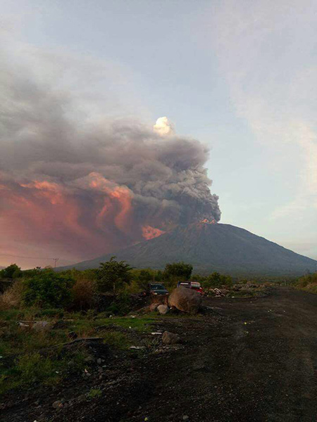
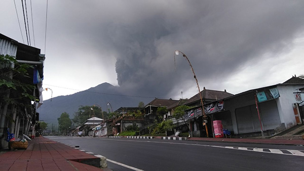
Over the past week, Mount Agung has continued to erupt, with increasing intensity and it now seems that magma is visible. Practically, the ash cloud has caused a few airlines to cancel flights to and from Ngurah Rai International Airport, (Denpasar International Airport-DPS), the VONA aeronautical threat leaves has been raised to red and the airport at Lombok (Bandar Udara Internasional-LOP) has been closed at least until Monday morning.
There is currently no threat to the main tourist areas at Kuta and Seminyak, which are about 70km (43 miles) from the volcano.
For those that are affected by this, our thoughts are with you.
The following are good resources for tracking the eruptions:
Mike Veitch and the Underwater Tribe’s Blog
Volcanologist Dr. Janine Krippher’s twitter feed.
MAGMA Indonesia’S twitter feed (In Indonesia, but translate is available.)
Sutopo Purwo Nugroho’s twitter feed(In Indonesia, but translate is available.)